OKLAHOMA BASED AERIAL SERVICESComanche Construction's Drone team is proud to offer an array of aerial drone services:
|
|
|
|
INTERIOR SCANNING SERVICESAdditionally, our state of the art team is equipped to provide interior scanning services through Matterport 3D Virtual Scan technology:
|
|
|
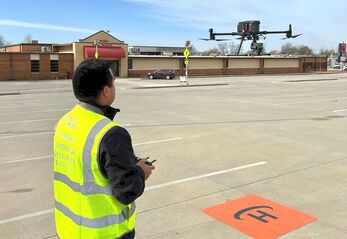
LICENSED PROFESSIONALFAA Part 107 Licensed professional pilots are ready to provide services for you!
|
WHAT WE OFFER
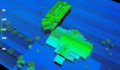
Aerial LiDARProcess point cloud data captured by the Zenmuse L1 in DJI Terra. In just one click, calculate POS data, fuse point cloud and visible light data, export point clouds in standardized formats, and generate fieldwork reports. LiDAR is great for aerial inspections, land and site surveys, forestry, land management, agriculture, mapping and more! Book your flight today!
|
|
|
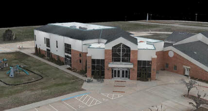
Aerial 3D ModelingOur drone services imports images captured from multiple angles, to auto-generate a realistic exterior 3D model. Three resolutions available––high, medium and low––for image reconstruction in diverse scenarios, such as surveying and mapping, accident sites, power grid equipment, and progress-tracking for construction projects, and more! Book your flight today!
|
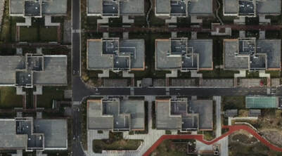
Aerial Mapping (2D+3D)We are able to generate high resolution orthomosaics, enabling you to get detailed and accurate measurement results for all your critical projects. Provides an aerial mapping overview of your property, city, project and more! Book your flight today!
|
|
|
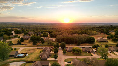
Aerial Photography & VideographyGet high resolution, marketing style, aerial still photos and video footage. Our drone pilots are able to capture footage of your subject, project or property from virtually any angle.
|
Interior Virtual Scanning (3D)Our state of the art team is equipped to provide interior scanning services through Matterport 3D Virtual Scan technology.
Our team can help digitize any type of space—from homes, offices, and hotels to factories and shops. These digital scanning services are perfect for virtual real estate tours, homeowners, architects, engineers and construction and so much more! Book your interior scan today! See a sample interior scan HERE. |
|
|
OtherIn addition to services listed above, we are able to offer other services upon request, such as: aerial thermal imaging, Roof and exterior building inspections (NOT licensed inspector services, aerial visual services provided only), and property flyovers and videography. Contact us to learn more today!
|
HOW OUR DRONE & SCANNING SERVICES WORK

1. Tell us about your needs
Contact us and let us know what your service needs are. We will provide you information, price quote, and details about services available.
|
|
